Trek Nepal’s Himalayas with Local Gurkhas Experts
Top Destinations
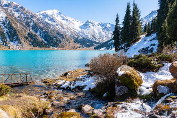
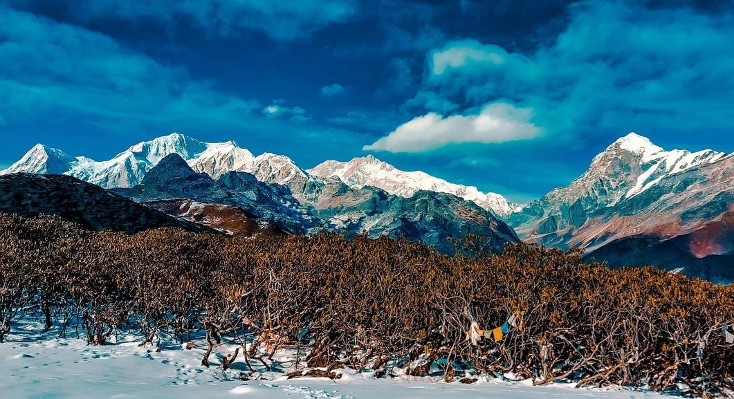
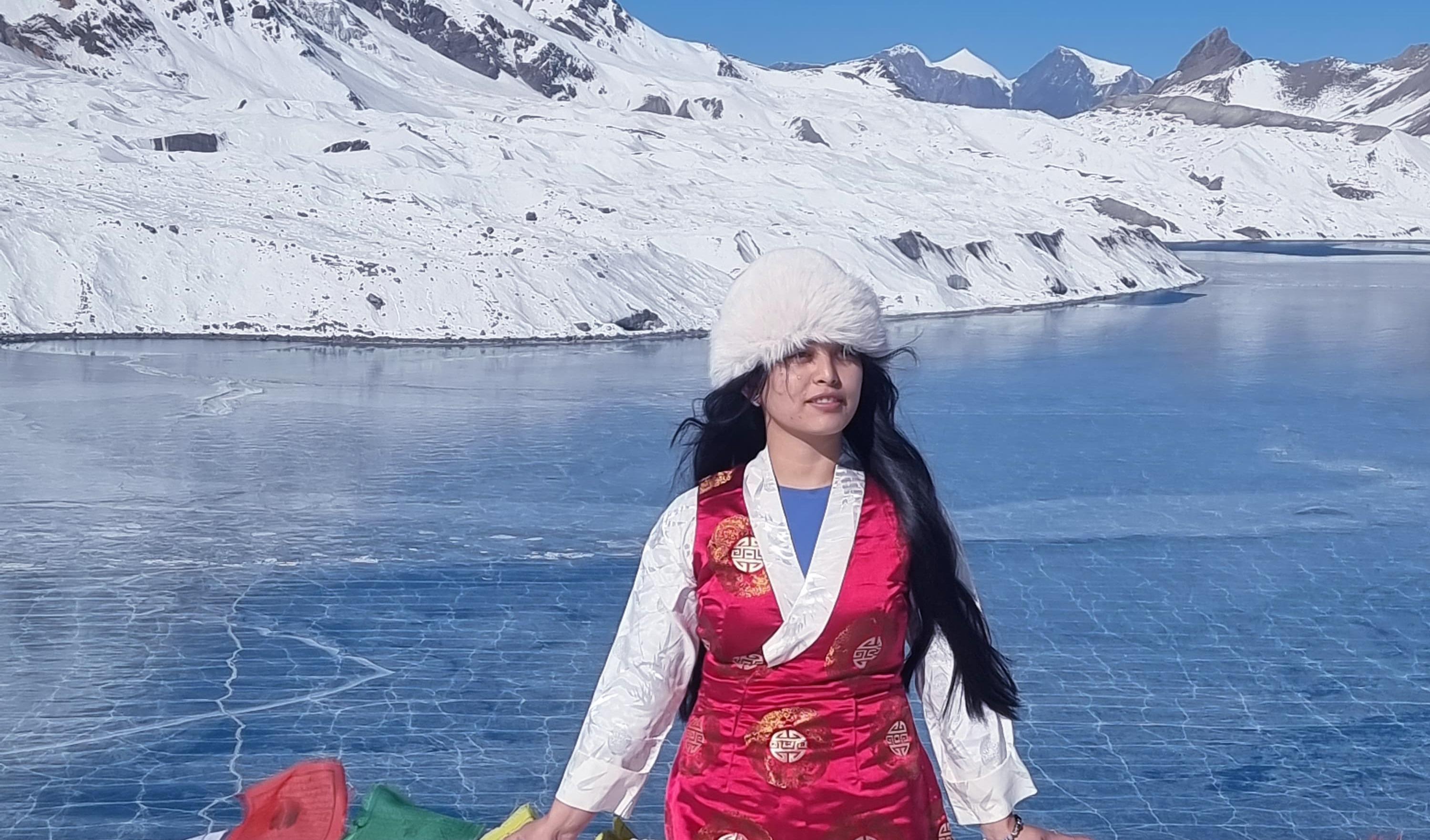
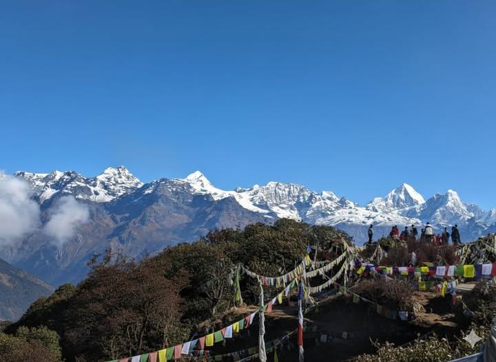
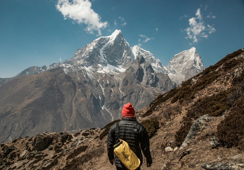
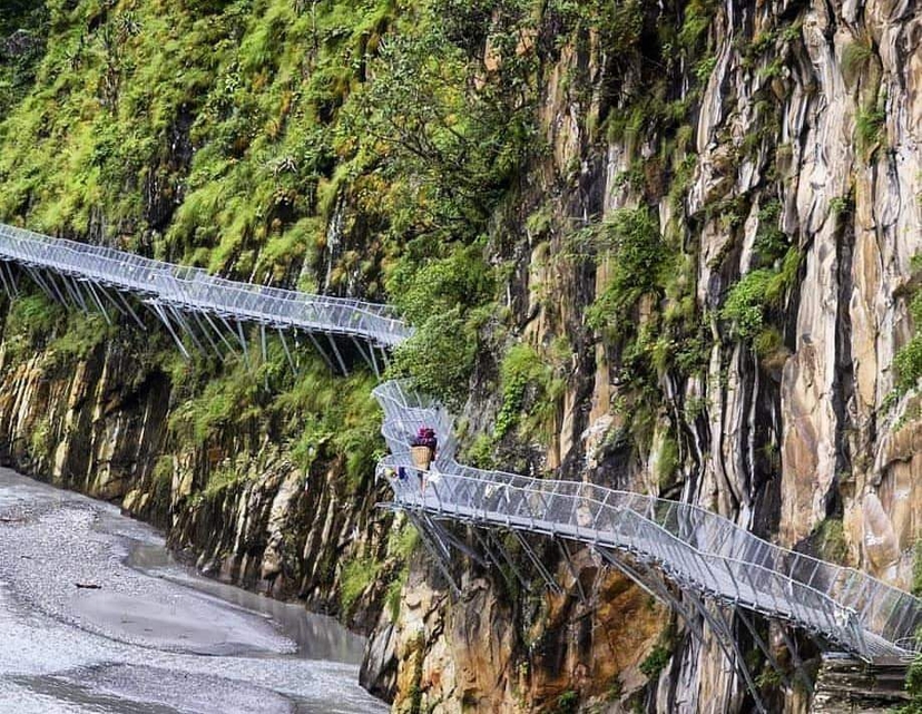
High-altitude treks, ancient trails & Himalayan adventures await you.
Features
Eco-Friendly Treks
Our trekking practices are sustainable and environmentally conscious, leaving minimal impact on the pristine trails of Nepal.
Authentic Cultural Experience
Immerse yourself in the rich Nepali culture with village homestays, traditional meals, and local interactions.
24/7 Support
Get round-the-clock assistance for your trekking journey, ensuring a hassle-free adventure.
Custom Itineraries
We design personalized trekking plans tailored to your fitness level, preferences, and time constraints.
Popular Countries

Netherland
10 Clients Served

Australia
12 Clients Served

USA
15 Clients Served

Malaysia
12 Clients Served

United Kingdom
5 Clients Served

Germany
7 Clients Served

France
18 Clients Served

India
16 Clients Served

Singapore
70 Clients Served
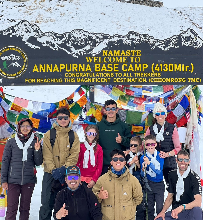
Explore Our Itineraries
Ama Yangri Trek
Day 1
Arrival In Kathmandu(1,350m)
Our team(trek guide/representatives) will be waiting for you at Tribhuvan International Airport in Kathmandu with garland of marigold flowers to have a warm welcome in the land of mountains. Transfer to hotel by a private car/vehicle then you will be briefing for preparation of the trek, shopping and rest time. Explore: Thamel's vibrant streets, traditional markets, visit Boudhanath/Swayambhunath if you arrived in time. Vibe: Buzzing cultural atmosphere, pre-trek excitement. Overnight at a 4 star hotel at Thamel in Kathmandu.
Day 2
Drive From Kathamdu To Timbu(1,580m) Then Trek To Tarkegyang(2,600m)
Drive Distance: 75 Km. Drive Duration: 4-5 hours. Trek Distance: 10 Km. Trek Duration: 5-6 hours. Elevation Gain: + 1,250m. After having your breakfast at your hotel, you begin your journey with a scenic drive from Kathmandu to Timbu, followed by a steady uphill trek to the beautiful Helambu village of Tarkegyang. Early in the morning, you leave Kathmandu by private vehicle and drive northeast along the Melamchi road. As you travel, you pass through small towns, terraced farmland, green hills and riverside settlements. The road gradually descends toward Melamchi Bazaar , where you can see the Melamchi River flowing through the valley. From Melamchi, you continue driving on a narrower rural road , surrounded by forests, waterfalls and traditional villages, until you reach Timbu(1,580m) , which is the starting point of your trek in the Helambu region . After a short rest at Timbu, you begin your trek toward Tarkegyang . The trail starts with a gentle walk through cultivated fields and small local settlements, then gradually climbs uphill through rhododendron and pine forests. As you continue walking, you pass through peaceful villages inhabited by Sherpa and Hyolmo people , where you can observe their traditional lifestyle, prayer flags, chortens and monasteries along the trail. The climb becomes steeper as you approach Tarkegyang but the trail remains scenic and rewarding. After several hours of walking, you arrive at Tarkeghyang(2,600m) , one of the largest and most culturally important villages in the Helambu region. The village is known for its ancient monastery, stone houses and beautiful mountain surroundings. From here, you can enjoy the peaceful atmosphere, local culture and the first clear views of the Himalayan hills , making it a perfect place to stay overnight.
Day 3
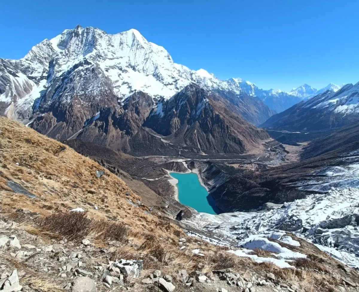
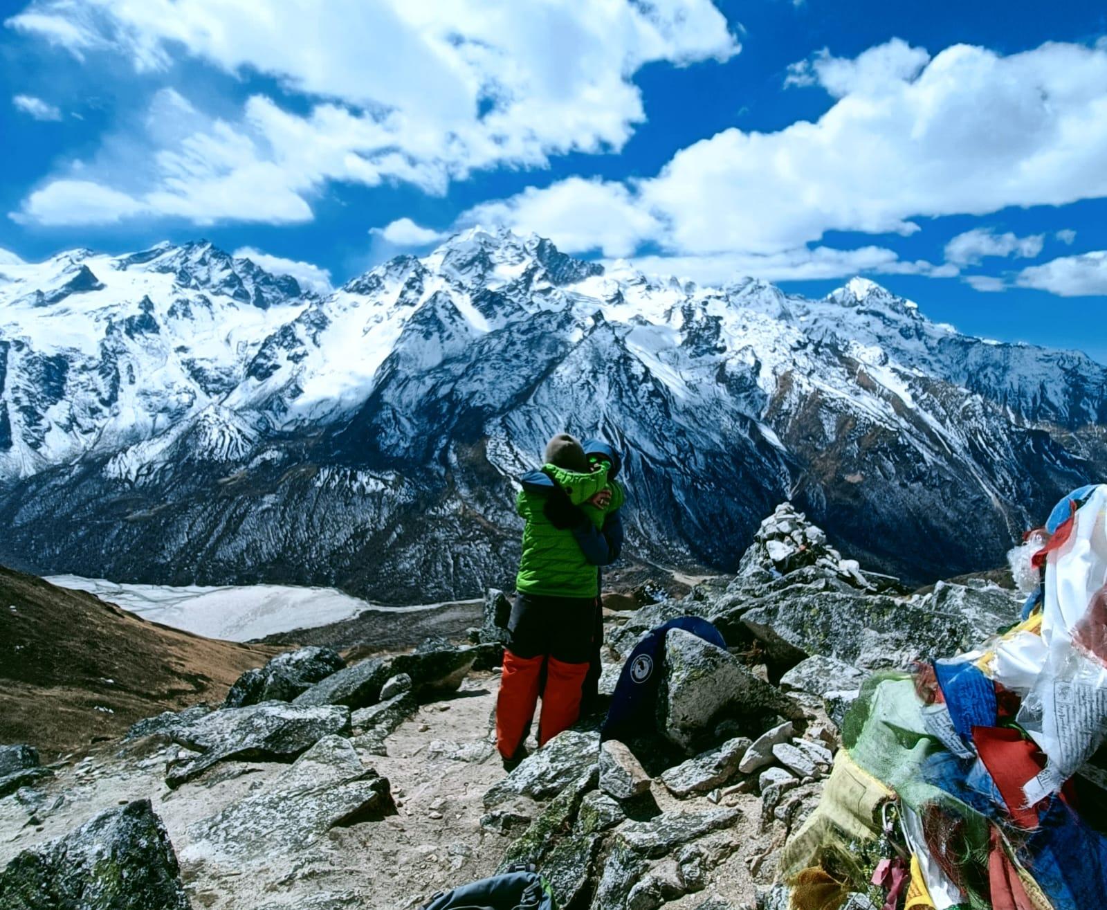
Hike To Ama Yangri Peak(3,771m) & Back To Tarkeghyang(2,600m)
Hiking Distance: 10 Km. Hiking Duration: 5-6 hours. Elevation Gain/Loss: +1171m./-1171m On this day, you wake up early in Tarkeghyang(2,600m) to hike to the sacred peak of Ama Yangri, the highest point of the trek and the best viewpoint in the Helambu region. Early in the morning, you start hiking uphill from Takeghyang through dense rhododendron and pine forest . The trail climbs steadily along a ridge and as you gain altitude, the forest becomes thinner and the views begin to open. Prayer flags, mani walls and small chortens along the trail show the strong Buddhist culture of the Helambu area. As you continue climbing, you walk on a steep but well-defined trail , passing through quiet alpine forest and open grassland. The air becomes cooler and the scenery more dramatic as you approach the top. After several hours of hiking, you finally reach Ama Yangri Peak(3,771m) , one of the most sacred mountains for the Hyolmo people. From the summit, you can enjoy a wide panoramic view of the Himalayas , including Langtang Lirung(7,227m), Dorje Lakpa(6,966m), Himal Range, Rolwaling Range, Everest(far view in clear weather) . You can spend some time at the top enjoying the sunrise, taking photos and experiencing the peaceful mountain atmosphere. After the break, you return to Tarkegyang by the same trail, descending through the forest and villages . The downhill walk is easier but requires careful steps. After reaching Tarkeghyang, you rest at the lodge and enjoy the quiet evening in this traditional Helambu village.
Day 4
Trek From Tarkegyang To Sermathang(2,620m)
Trek Distance: 8 Km. Trek Duration: 4-5 hours. Elevation Gain: +20m. On this day, you leave Tarkeghyang(2,600m) and continue trekking along the beautiful ridge trails of the Helambu region toward Sermathang)2,620m). Compared with the previous day's steep hike to Ama Yangri, this section of the trek is more relaxing and mostly follows a gentle trail through forest and traditional villages. After breakfast, you start walking from Tarkeghyang through pine and rhododendron forests , passing mani walls, prayer flags and small chortens that reflect the strong Buddhist culture of the region. The trail follows a scenic ridge with occasional views of distant mountains and green hills. As you continue trekking, you pass through small settlements and farmland where you can see the daily life of the Hyolmo and Sherpa communities . Along the way, you may encounter traditional houses, monasteries and terraced fields where locals grow crops such as potatoes, barley and vegetables. The trail includes gentle ups and downs but is generally comfortable to walk. After several hours of trekking through peaceful forest and village landscapes, you arrive at Sermathang(2,620m) , a beautiful and quiet Sherpa village known for its monasteries, wide grassy fields and scenic views. Sermathang is one of the cultural centers of the Helambu region. After reaching the village, you can explore the local monastery, walk around the village and enjoy the calm Himalayan atmosphere before resting for the night at a local lodge.
Day 5
Trek From Sermathang To Timbu Then Drive To Kathmandu(1,350m)
Trek Distance: 7 Km. Trek Duration: 3-4 hours. Drive Distance: 75 Km. Drive Duration: 5-6 hours. Elevation Loss: -1270m On this day, you finish your trek in the Helambu region by walking from Sermathang down to Timbu and then driving back to Kathmandu. This day is easier compared to previous trekking days because most of the trail goes downhill. After breakfast, you leave Sermathang(2,620m) and start trekking through peaceful forest trails and small villages. The path gradually descends through pine and rhododendron forest, passing prayer flags, chortens and farmland. As you walk, you can enjoy the last views of the Helambu hills and traditional Hyolmo and Sherpa villages . The trail continues downhill toward the Melamchi valley and after a few hours of walking, you reach Timbu(1,580m) , which is the road head and ending point of the trek. Here you take a short rest and prepare for the dive back to Kathmandu. From Timbu, you drive along the Melamchi road back toward Kathmandu . The road passes through Melamchi Bazaar, riverside villages, terraced fields and green hills. After several hours of scenic driving, you arrive in Kathmandu , where your trekking journey ends. You can relax at the hotel or explore the city in the evening.
Day 6
Final Departure.
Transfer to airport by private vehicle; included, final goodbye, End of an epic Himalayan experience; unforgettable mountain memories. Thank You Very Much for being with us.
Day 1
Arrival In Kathmandu(1,350m)
Our team(trek guide/representatives) will be waiting for you at Tribhuvan International Airport in Kathmandu with garland of marigold flowers to have a warm welcome in the land of mountains. Transfer to hotel by a private car/vehicle then you will be briefing for preparation of the trek, shopping and rest time. Explore: Thamel's vibrant streets, traditional markets, visit Boudhanath/Swayambhunath if you arrived in time. Vibe: Buzzing cultural atmosphere, pre-trek excitement. Overnight at a 4 star hotel at Thamel in Kathmandu.
Day 2
Drive From Kathamdu To Timbu(1,580m) Then Trek To Tarkegyang(2,600m)
Drive Distance: 75 Km. Drive Duration: 4-5 hours. Trek Distance: 10 Km. Trek Duration: 5-6 hours. Elevation Gain: + 1,250m. After having your breakfast at your hotel, you begin your journey with a scenic drive from Kathmandu to Timbu, followed by a steady uphill trek to the beautiful Helambu village of Tarkegyang. Early in the morning, you leave Kathmandu by private vehicle and drive northeast along the Melamchi road. As you travel, you pass through small towns, terraced farmland, green hills and riverside settlements. The road gradually descends toward Melamchi Bazaar , where you can see the Melamchi River flowing through the valley. From Melamchi, you continue driving on a narrower rural road , surrounded by forests, waterfalls and traditional villages, until you reach Timbu(1,580m) , which is the starting point of your trek in the Helambu region . After a short rest at Timbu, you begin your trek toward Tarkegyang . The trail starts with a gentle walk through cultivated fields and small local settlements, then gradually climbs uphill through rhododendron and pine forests. As you continue walking, you pass through peaceful villages inhabited by Sherpa and Hyolmo people , where you can observe their traditional lifestyle, prayer flags, chortens and monasteries along the trail. The climb becomes steeper as you approach Tarkegyang but the trail remains scenic and rewarding. After several hours of walking, you arrive at Tarkeghyang(2,600m) , one of the largest and most culturally important villages in the Helambu region. The village is known for its ancient monastery, stone houses and beautiful mountain surroundings. From here, you can enjoy the peaceful atmosphere, local culture and the first clear views of the Himalayan hills , making it a perfect place to stay overnight.
Day 3
Hike To Ama Yangri Peak(3,771m) & Back To Tarkeghyang(2,600m)
Hiking Distance: 10 Km. Hiking Duration: 5-6 hours. Elevation Gain/Loss: +1171m./-1171m On this day, you wake up early in Tarkeghyang(2,600m) to hike to the sacred peak of Ama Yangri, the highest point of the trek and the best viewpoint in the Helambu region. Early in the morning, you start hiking uphill from Takeghyang through dense rhododendron and pine forest . The trail climbs steadily along a ridge and as you gain altitude, the forest becomes thinner and the views begin to open. Prayer flags, mani walls and small chortens along the trail show the strong Buddhist culture of the Helambu area. As you continue climbing, you walk on a steep but well-defined trail , passing through quiet alpine forest and open grassland. The air becomes cooler and the scenery more dramatic as you approach the top. After several hours of hiking, you finally reach Ama Yangri Peak(3,771m) , one of the most sacred mountains for the Hyolmo people. From the summit, you can enjoy a wide panoramic view of the Himalayas , including Langtang Lirung(7,227m), Dorje Lakpa(6,966m), Himal Range, Rolwaling Range, Everest(far view in clear weather) . You can spend some time at the top enjoying the sunrise, taking photos and experiencing the peaceful mountain atmosphere. After the break, you return to Tarkegyang by the same trail, descending through the forest and villages . The downhill walk is easier but requires careful steps. After reaching Tarkeghyang, you rest at the lodge and enjoy the quiet evening in this traditional Helambu village.
Day 4
Trek From Tarkegyang To Sermathang(2,620m)
Trek Distance: 8 Km. Trek Duration: 4-5 hours. Elevation Gain: +20m. On this day, you leave Tarkeghyang(2,600m) and continue trekking along the beautiful ridge trails of the Helambu region toward Sermathang)2,620m). Compared with the previous day's steep hike to Ama Yangri, this section of the trek is more relaxing and mostly follows a gentle trail through forest and traditional villages. After breakfast, you start walking from Tarkeghyang through pine and rhododendron forests , passing mani walls, prayer flags and small chortens that reflect the strong Buddhist culture of the region. The trail follows a scenic ridge with occasional views of distant mountains and green hills. As you continue trekking, you pass through small settlements and farmland where you can see the daily life of the Hyolmo and Sherpa communities . Along the way, you may encounter traditional houses, monasteries and terraced fields where locals grow crops such as potatoes, barley and vegetables. The trail includes gentle ups and downs but is generally comfortable to walk. After several hours of trekking through peaceful forest and village landscapes, you arrive at Sermathang(2,620m) , a beautiful and quiet Sherpa village known for its monasteries, wide grassy fields and scenic views. Sermathang is one of the cultural centers of the Helambu region. After reaching the village, you can explore the local monastery, walk around the village and enjoy the calm Himalayan atmosphere before resting for the night at a local lodge.
Day 5
Trek From Sermathang To Timbu Then Drive To Kathmandu(1,350m)
Trek Distance: 7 Km. Trek Duration: 3-4 hours. Drive Distance: 75 Km. Drive Duration: 5-6 hours. Elevation Loss: -1270m On this day, you finish your trek in the Helambu region by walking from Sermathang down to Timbu and then driving back to Kathmandu. This day is easier compared to previous trekking days because most of the trail goes downhill. After breakfast, you leave Sermathang(2,620m) and start trekking through peaceful forest trails and small villages. The path gradually descends through pine and rhododendron forest, passing prayer flags, chortens and farmland. As you walk, you can enjoy the last views of the Helambu hills and traditional Hyolmo and Sherpa villages . The trail continues downhill toward the Melamchi valley and after a few hours of walking, you reach Timbu(1,580m) , which is the road head and ending point of the trek. Here you take a short rest and prepare for the dive back to Kathmandu. From Timbu, you drive along the Melamchi road back toward Kathmandu . The road passes through Melamchi Bazaar, riverside villages, terraced fields and green hills. After several hours of scenic driving, you arrive in Kathmandu , where your trekking journey ends. You can relax at the hotel or explore the city in the evening.
Day 6
Final Departure.
Transfer to airport by private vehicle; included, final goodbye, End of an epic Himalayan experience; unforgettable mountain memories. Thank You Very Much for being with us.
Testimonials
Loading testimonials...

Recognized & Trusted
Our Certifications & Affiliations
Government of Nepal
Nepal Tourism Board
Uncover Hidden Wilderness Together!
Often celebrated as a harmonious union of physical activity and natural exploration become an enriching journey for both body and mind.
